Malaysia Airlines Flight 370 Google Maps Sightings
Malaysia Airlines Flight 370 disappeared on March 8, 2014. It was traveling from Kuala Lumpur to Beijing. There were 239 people onboard. The aircraft was a Boeing 777-200ER. It lost contact with air traffic control less than an hour after takeoff. The flight then vanished from civilian radar screens. Later, military radar showed that it turned west and flew across the Malaysian peninsula. It then flew out over the Andaman Sea. After that, the aircraft disappeared again. No further contact was made.
Over the years, search efforts have covered vast ocean areas. The aircraft has still not been recovered. Only small pieces of debris have been found. These were confirmed to be parts of the missing plane.
The disappearance has led to many theories. Some are based on official data. Others are based on speculation. A growing number of people have tried to find the plane using Google Maps and Google Earth.
Public Interest in Malaysia Airlines Flight 370 Google Maps
Soon after the plane disappeared, people turned to technology. Google Maps and Google Earth became tools for amateur investigators. Users around the world started scanning satellite images. They hoped to find traces of the plane. The idea was simple. If satellite images covered wide areas, maybe the wreckage could be spotted. This led to several viral claims.
Some users believed they saw a plane-shaped object in satellite images. One such sighting appeared in the Cambodian jungle. Another was spotted off the coast of Thailand. These claims gained traction on social media. Videos and articles were shared widely. Some news sites even published the coordinates. These posts attracted global attention. People hoped that someone had finally found the missing plane.
The Cambodian Jungle Theory of Malaysia Airlines Flight 370 Google Maps
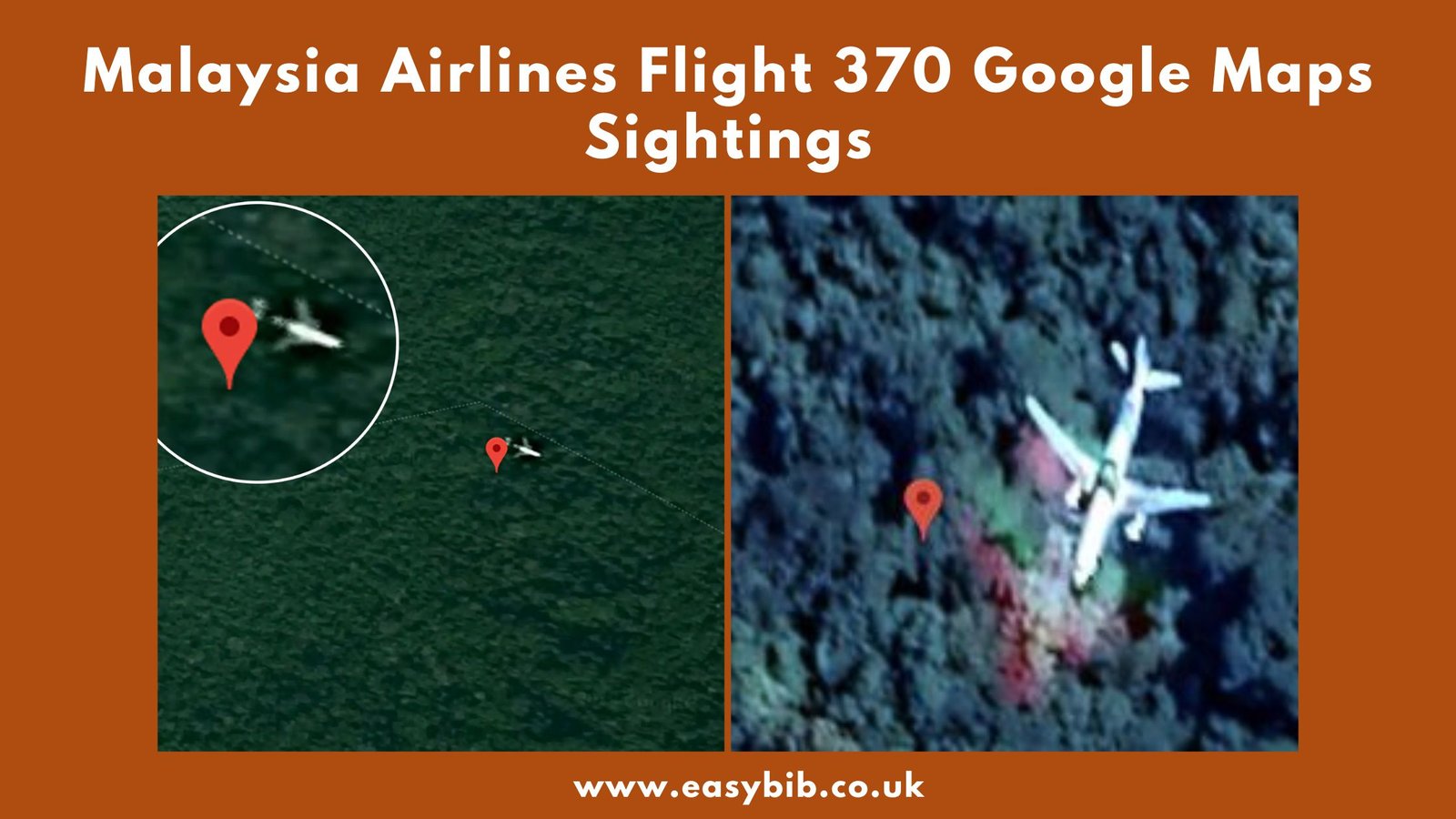
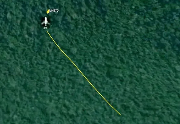
In 2018, British video producer Ian Wilson claimed to have found the plane. He said it appeared on Google Maps. The object he found was in the Cambodian jungle. It was shaped like an airplane.
He said the size was similar to a Boeing 777. He also pointed out a separation between the tail and the main body. Wilson suggested this could be the wreckage of MH370. He shared his discovery with several media outlets. The story quickly went viral.
Wilson even planned to travel to the site. He wanted to check the object in person. A few others claimed to find the same object. But soon, questions were raised. Many experts analyzed the images.
They said the object was likely a flying plane captured by satellite. Some even pointed out that the image had been on Google Maps before 2014. That meant it could not be MH370. The theory began to lose support. Still, it showed how people used online tools to help with the mystery.
How Google Maps Can Mislead?
Google Maps and Google Earth use satellite images. But these images are not live. Some are months or even years old. So, anything visible now may have appeared long before the disappearance.
Also, satellite images can be tricky. Sometimes, planes in flight appear as still images. The satellite captures them mid-air. That creates the illusion of a crashed plane on the ground. Weather effects, cloud shapes, and image glitches also mislead viewers.
In some cases, these illusions can look very real. That’s why experts caution people. They remind users that satellite tools are not perfect. They should not be used as proof unless verified. Many of the supposed sightings, like the one in Cambodia, were reviewed. None were confirmed by aviation authorities. No official investigation found them credible. This shows the limits of using Google Maps for such complex searches.
Official Investigations and the Indian Ocean Focus
After MH370 disappeared, multiple agencies joined the search. Australia, Malaysia, and China led the efforts. Other countries offered support. The search focused on the southern Indian Ocean. Why? Because satellite data showed that the plane continued flying for hours. It sent automatic “handshakes” to an Inmarsat satellite. These signals helped experts track its flight path. The final signal came from a location deep in the ocean. That area became the center of the search.
The first major search operation lasted until 2017. It covered over 120,000 square kilometers. Then in 2018, a private company called Ocean Infinity tried again. They used advanced underwater vehicles. But both efforts failed to find the plane. The only confirmed parts were found on beaches in Africa and nearby islands.
These included parts of the wing and flaperon. Each piece matched the aircraft type and serial numbers. This confirmed the plane crashed in the Indian Ocean. It also ruled out other locations like Cambodia.
Why Google Maps Sightings Persist?
The mystery of MH370 remains unsolved. This fuels public interest. People want answers. When governments stop searching, the public keeps looking. Google Maps is a free and easy tool. Anyone can use it. Some users search for hours. They believe they might see something experts missed. Viral posts and videos add fuel to this fire. Some YouTubers even build their channels around such content. They post updates about new “findings” on the map. Most of these are later debunked.
But the cycle continues. The hope that someone might finally spot the wreckage is strong. For families of victims, such claims can be painful. They raise hopes without proof.
Experts warn the public to be careful. They remind users to verify facts. Emotional stories may go viral, but they are not always true. So far, no Google Maps sighting has been confirmed by any investigation.
Conclusion
Malaysia Airlines Flight 370 is one of aviation’s greatest mysteries. The plane disappeared with 239 people onboard. Official searches focused on the Indian Ocean. Satellite data supported this direction. Google Maps sightings, while popular, have not led to any confirmed discoveries.
Claims like the Cambodian jungle theory were debunked. Yet public interest remains strong. People still search satellite images hoping to solve the puzzle. But for now, the truth remains hidden deep in the ocean. Until the wreckage is found, the mystery will continue.